Available at a very affordable price for a limited time!


⚡ Digital download – Fully editable and scalable. You can use Maptorian vector maps to create all the maps you want, both for personal and commercial use. Maps created from Maptorian can be used for any purpose (see license).
MAIN FEATURES OF THE MAPTORIAN FULL EDITION
- Digital download (10GB of downloadable maps in several files)
- A reduced price to get the entire map bundle.
- A license to use the maps for any project, including commercial projects.
- The maps are updated on a regular basis, and these updates are offered at no additional cost to former buyers of this pack.
- Maps in vector format, scalable without loss of quality.
- Maps in AI format for Adobe Illustrator (CS3 or higher), fully editable and layered (the maps can also be imported and edited with graphic design programs such as Inkscape or Affinity Designer).
- All the information is distributed in thematic layers (scale, topography, coasts, capitals of the world and of states, cities, administrative divisions, rivers, roads, railroads…)
- All layers, objects, colors, and labels are editable.
- Vector world maps with three different levels of detail: low, medium, and high.
- Continents, regions, and country maps (Africa, Asia, Oceania, Europe, America, USA…)
- Topographic vector maps (Miller projection).
THE FULL EDITION contains
- WORLD MAPS (High detail): 20 maps + auxiliary maps
- WORLD MAPS (Medium detail): 30 maps
- WORLD MAPS (Low detail): 8 maps
- CONTINENTS/COUNTRIES HIGH DETAIL MAPS: 21 maps
- TOPOGRAPHIC MAPS: 9 maps
- Supplementary Maps and Physical Backgrounds
Details of each map type included in the full edition
HIGH DETAIL MAPS
Vector world maps (high detail).
Digital download.
Pack size (ZIP 2 Files): 1,5 + 2 GB.
Contains 20 maps (4 projections) + auxiliary maps.
Layers: 40.
Minimum software required: Adobe Illustrator CS3 or equivalent vector software (Layered AI format.
Minimum RAM required: 2GB (4 GB recommended).


Maps of continents, countries, and regions
Digital download.
Pack size (ZIP): 1,30 GB.
Contains 21 maps + auxiliary maps.
Layers: 40.
Minimum software required: Adobe Illustrator CS3 or equivalent vector software (Layered AI format).
Minimum RAM required: 2GB (4 GB recommended).


MEDIUM DETAIL MAPS
Digital download.
Pack size (ZIP 2 Files): 1,60 + 2 GB.
Contains 30 maps (16 projections) + auxiliary maps.
Layers: 40.
Minimum software required: Adobe Illustrator CS3 or equivalent vector software (Layered AI format).
Minimum RAM required: 2GB.


TOPOGRAPHIC VECTOR MAPS
 Topographic World Maps + Bathymetry. Digital download.
Projection: Miller.
Pack size (ZIP): 1,8 GB.
Contains 9 maps. (Africa + Asia and Oceania + Europe and the Middle East + North and Central America + South America + World Topography Compositions).
Minimum software required: Adobe Illustrator CS3.
Minimum RAM required: 8GB (16 GB recommended).
Formats: AI (Adobe Illustrator).
Layers included (9 + auxiliary layers with countries and political features). Scale, Graticules, Lakes, Rivers, Glaciated Areas, Coast, Bathymetry (Oceans), Shaded Relief (Raster), Topographic (Vector) + Additional layers (physical geography labels).


LOW DETAIL MAPS
Four simple world maps, ideal for creating small presentation maps, web maps, or similar. Projections: Mercator, Miller, Robinson, and WGS84. Formats: AI for Illustrator and PDF.


Thematic layers (full edition)
Most of the maps include a layer with a graphic scale referring to the equator.
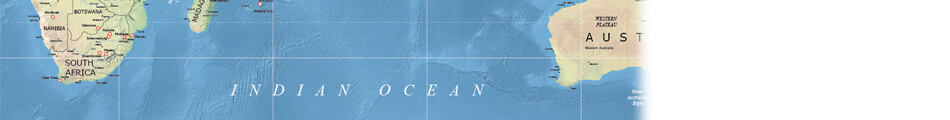


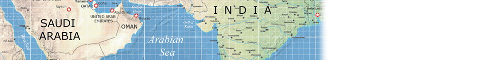


Screenshots
All objects, labels and elements are editable. Maptorian is an awesome map collection designed to easily create your own map projects for personal or commercial use without any restriction.
Maptorian is a vector map collection created thinking about the work of graphic designers, journalists, students and people who need to create visually appealing maps easily and quickly.
With the layered maps of Maptorian, any person who knows how to handle a current vector graphic design program, especially a program like Illustrator, can easily shape their own maps.


