I dare say that, of all the stories about lost continents, lost islands and other geographical myths, one of them stands out above the rest: Atlantis. It is incredible how many articles, books, films and similar products have been created around what, in principle, were just a few simple Plato’s comments. As if it were some kind of madness, since the 18th century many have been searching for the location of the mythical island sunk by the gods in the sea.
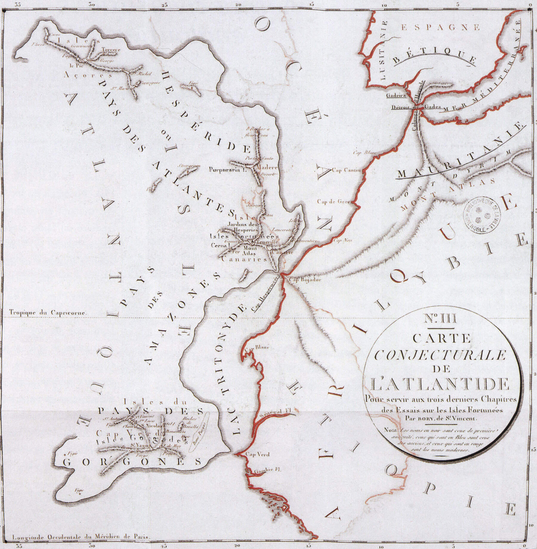
There have been so many authors who have believed that Atlantis was in the Sahara, or in the Mediterranean, the Caribbean or the Far East, that if a red dot is placed on a map for each of these suggested locations, we will obtain a mosaic of polka dots. Others have focused on what Plato said, letting their imagination run wild and, among them all, it was undoubtedly the map created by Jean-Baptiste Bory of Saint-Vincent that was the most attractive and curious. This French geographer was a tireless explorer and academic, one of the forerunners of modern volcanology and, in addition, a passionate fan of myths. It was this passion that led him to speculate what Atlantis might have been like, as a mythical great island situated “beyond the Pillars of Hercules” (the Straits of Gibraltar).
In 1803 he published a book on the subject in which he included his hypothetical map of Atlantis, undoubtedly the best map on this evanescent subject. In this map, which is reproduced below, the geographer proposed the existence of Atlantis as an continent between the Canary Islands, Madeira, the Azores and Cape Verde, locating in its interior all kinds of mythical places, such as the country of the Amazons.